Unlocking the Earth’s Mysteries: A Comprehensive Guide to Geographic Research, Methodologies, and Real-World Applications
Introduction: The Scientific Pursuit of Planetary Phenomena
Human curiosity has long been captivated by the natural world. From everyday wonders like the meteorological conditions required to form a vibrant rainbow after a spring storm, to complex planetary anomalies such as rapid urbanization and its environmental fallout, our planet constantly demands our attention. While casual observation can spark curiosity, understanding the root causes of these phenomena requires a rigorous, systematic approach: geographic research.
Far from being a mere collection of map-making exercises or trivia about landforms, geographic research is a vital scientific discipline. It serves as the primary tool for investigating, analyzing, and solving complex problems related to the Earth’s systems. By employing specialized scientific frameworks, geographers unlock the underlying mechanisms driving environmental and human-induced changes, paving the way for sustainable development, effective disaster mitigation, and informed public policy.
Defining Geographic Research: Core Concepts and Scope
At its foundational level, geographic research is defined as a systematic, scientific investigation conducted to uncover truths or solve problems concerning geographic phenomena.

Unlike other academic pursuits—such as historical research, which focuses primarily on temporal sequences, or sociological studies, which center on human social behavior—geographic research focuses explicitly on geospatial phenomena. These phenomena are categorized within the five realms of the geosphere:
- Atmosfer: The gaseous envelope surrounding the Earth.
- Biosfer: The zones of life supporting plants, animals, and microorganisms.
- Hidrosfer: The totality of water found on, under, and above the Earth’s surface.
- Litosfer: The rigid outer shell of the planet, including the crust and upper mantle.
- Antroposfer: The human sphere, examining how human populations interact with and shape their environments.
To analyze these spheres effectively, geographic research relies on three core geographic approaches: spatial analysis (examining the arrangement of phenomena across space), ecological analysis (studying the interactions between organisms and their environments), and regional complex analysis (combining spatial and ecological perspectives to understand distinct geographic units).
The Scientific Pillars of Geographic Inquiry
To be recognized as a legitimate scientific endeavor, geographic research must adhere to a strict set of intrinsic properties and methodological standards.

1. Scientific Rigor and Evidence
A geographic study must be rooted firmly in established scientific principles. Speculation, conjecture, and unverified assumptions have no place in formal geographic inquiry; every hypothesis must be testable and backed by verifiable observation.
2. Discovery-Driven Focus
Geographic research is fundamentally driven by the exploration of unknown variables or unresolved problems within the geosphere. In research terminology, a "problem" does not merely signify a crisis or disaster; rather, it denotes a gap in knowledge—a question that has yet to be answered, such as the micro-climatic impacts of atmospheric particulate matter on urban precipitation patterns.
3. Developmental Continuity
Good geographic research possesses developmental value. The processes, methodologies, and conclusions derived from a single study often serve as building blocks for future scientific breakthroughs, cross-disciplinary applications, and expanded theoretical frameworks.
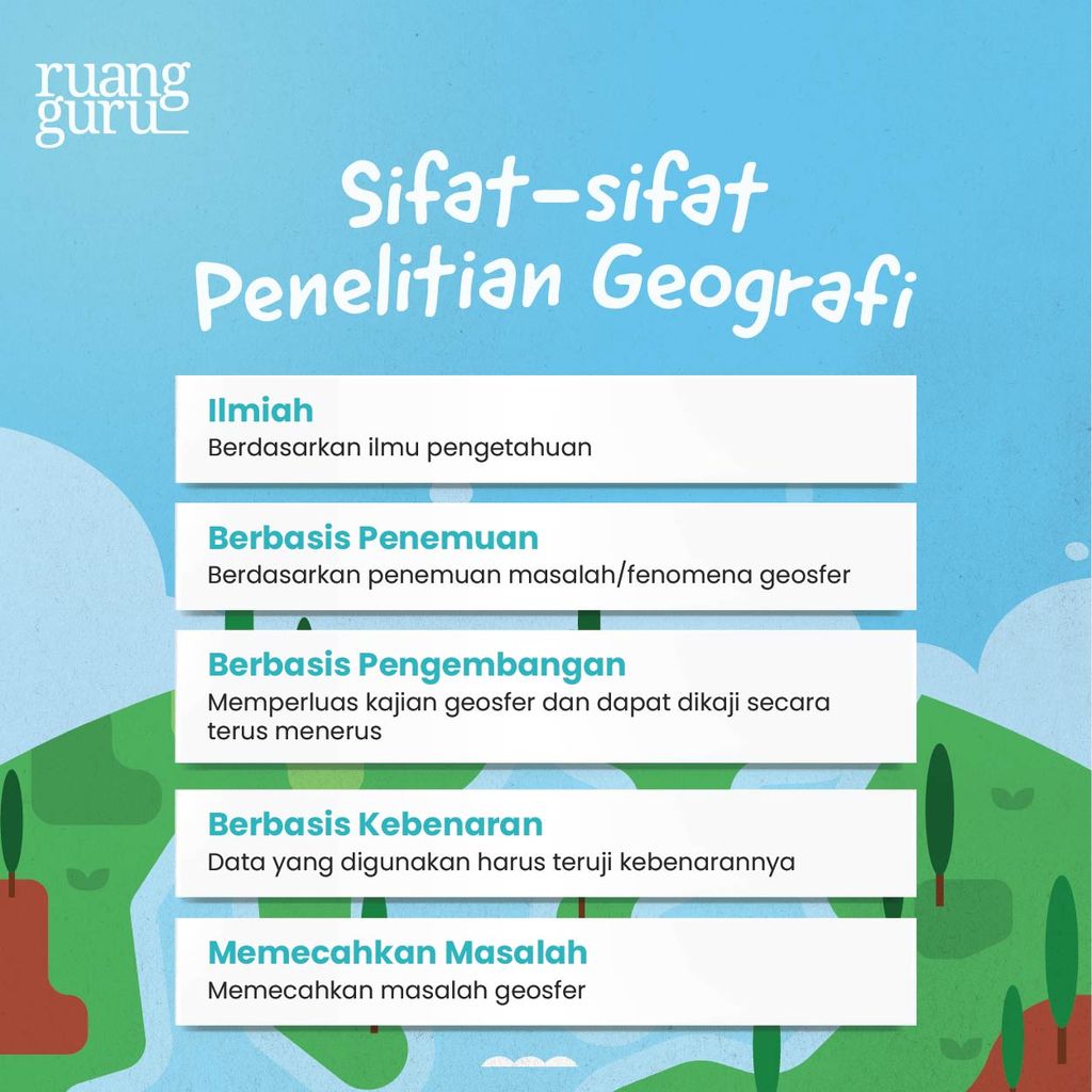
4. Empirical Verifiability and Truth
Integrity is paramount. All data utilized in geographic research must be authentic, factual, and gathered through rigorous primary or secondary collection methods, completely free of manipulation or fabrication.
5. Problem-Solving Orientation
Ultimately, geographic research is utilitarian. It seeks to generate actionable solutions to real-world challenges affecting the interactions between human societies and their natural surroundings.
Chronology and Classification of Geographic Research
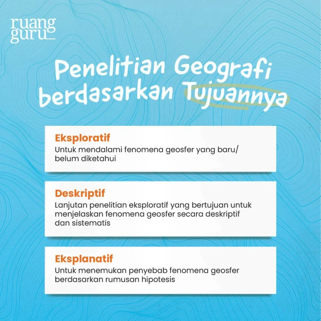
To execute a successful study, researchers must categorize their work based on specific investigative parameters. Geographic research is traditionally classified into three distinct categories: by its ultimate objective, by its execution methodology, and by its data analysis method.
Phase 1: Classification by Research Objective
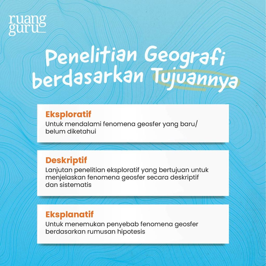
The objectives of a geographic study dictate the trajectory of data collection and analysis. They are typically broken down into three chronological tiers:
- Exploratory Research: This initial phase is deployed when a phenomenon is newly discovered or poorly understood. Researchers use field observations, interviews, and literature reviews to establish a baseline of knowledge. For example, an exploratory study on an unusual micro-climatic weather event would focus on gathering raw, foundational data regarding its basic characteristics.
- Descriptive Research: Serving as a natural successor to exploratory studies, descriptive research aims to systematically detail a phenomenon using qualitative and quantitative parameters, such as structural mapping, statistical breakdowns, and detailed narratives.
- Explanatory Research: The final analytical tier, explanatory research focuses on identifying the root causes of a phenomenon based on pre-formulated hypotheses. This phase establishes cause-and-effect relationships—answering not just what is happening, but why and how it occurs.
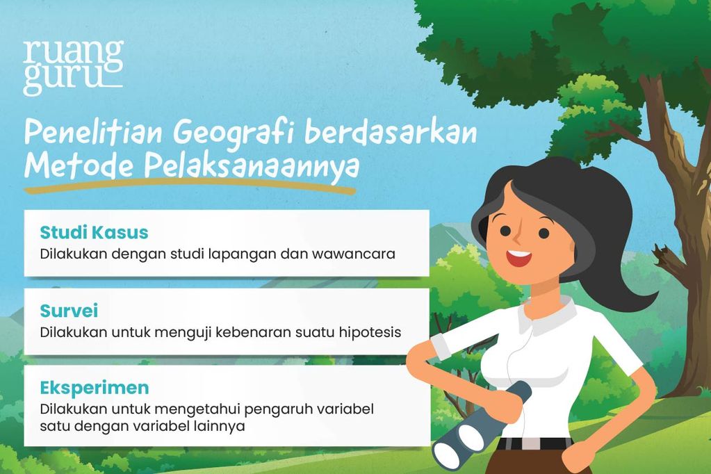
Phase 2: Classification by Implementation Methodology
Once research objectives are established, investigators must select the appropriate operational framework:
- Case Studies: Involving deep-dive investigations into specific, bounded real-world scenarios through direct fieldwork and qualitative interviews.
- Surveys: Utilized primarily to test hypotheses or generalized conclusions across a broader demographic or spatial sample.
- Experiments: Designed to isolate and measure the impact of specific independent variables on dependent variables. These can be conducted either in controlled laboratory environments or through field experiments.
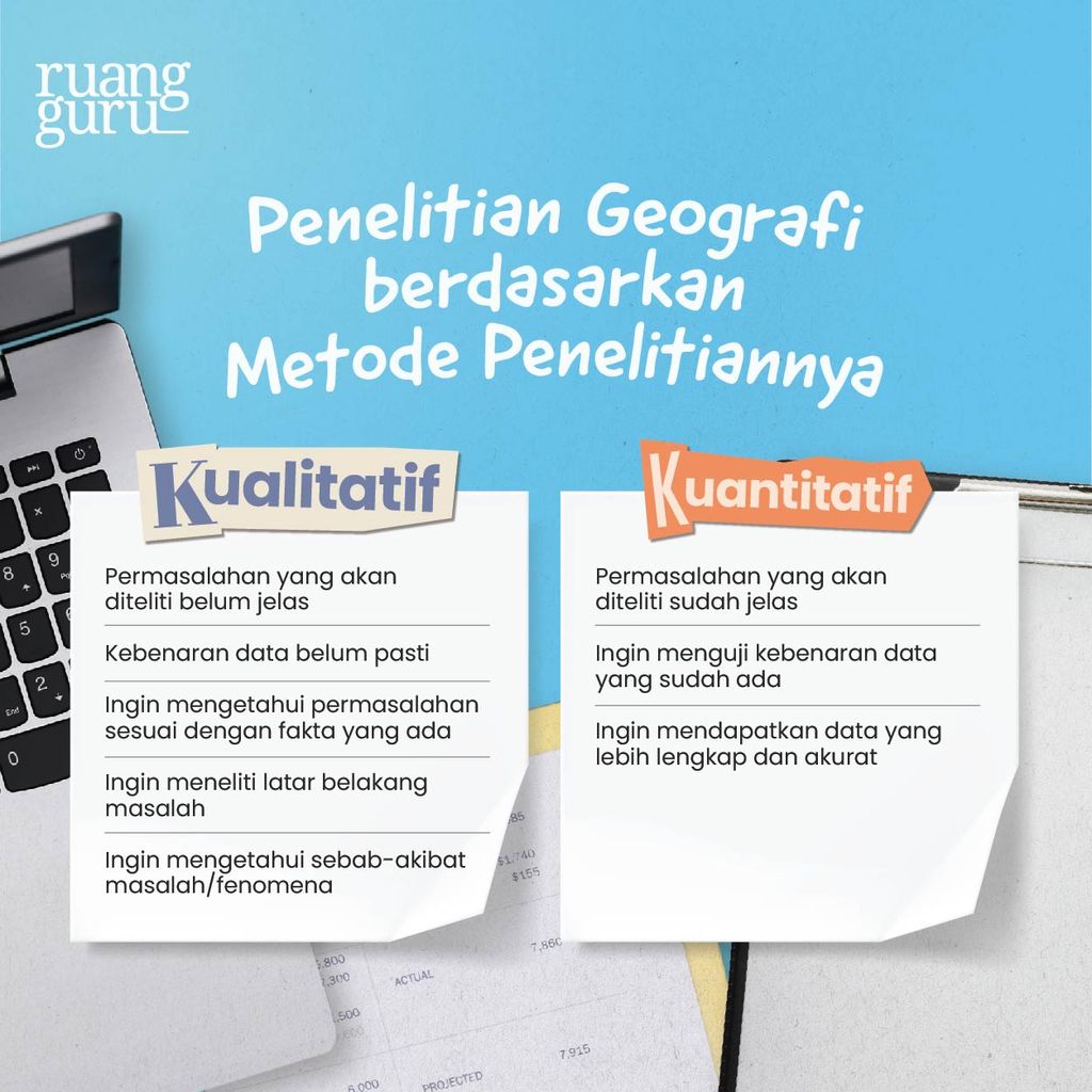
Phase 3: Qualitative versus Quantitative Methods
Researchers must also determine their analytical framework based on the nature of the data required:
- Quantitative Methods: Focus on numerical data, statistical modeling, and mathematical computations, making them ideal for precise measurement, spatial modeling, and explanatory research.
- Qualitative Methods: Focus on narrative descriptions, behavioral patterns, and contextual observations, making them exceptionally well-suited for exploratory and descriptive frameworks.
Supporting Data: A Real-World Research Proposal
To contextualize how these theoretical frameworks operate in a professional setting, consider the following blueprint for a geographic research proposal addressing contemporary environmental challenges.
Research
“The Impact of Land-Cover Transformation on Flood Risks in Jakarta’s Suburban Fringe”
Background and Context
Rapid population growth and accelerated urbanization in Jakarta’s suburban periphery have triggered intensive land-use changes. Permeable green spaces, agricultural zones, and wetlands are systematically being replaced by impermeable surfaces such as asphalt, concrete rooftops, and industrial complexes. This drastic transformation alters surface runoff dynamics, drastically reducing infiltration rates and exponentially amplifying regional flood risks during seasonal monsoons.
Research Objectives
- To quantify and map land-cover changes across suburban Jakarta over the preceding decade.
- To establish the statistical correlation between diminished green cover and the escalating frequency and severity of localized flood events.
- To formulate science-backed environmental management recommendations designed to mitigate future flood vulnerabilities.
Methodology and Implementation
- Data Collection: Multi-spectral satellite imagery spanning a 10-year period, historical hydrological flood logs compiled by meteorological agencies, and regional precipitation records.
- Data Analysis: Utilizing Geographic Information Systems (GIS) for spatial change detection mapping, applying statistical correlation tests to link land-use metrics with flood data, and running hydrologic simulations to project future flood exposure zones.
Official Responses and Implications
As environmental pressures mount globally, academic institutions, urban planners, and governmental bodies increasingly rely on geographic research to guide policy decisions.
According to urban planning authorities and academic consortia, traditional zoning laws that fail to account for geospatial realities are no longer viable. Official municipal responses to recurring urban crises—such as the severe flooding observed in Southeast Asian megacities—highlight an ongoing shift toward ecological spatial planning.
Policy and Societal Implications
- Informed Infrastructure Development: Municipalities are utilizing GIS-based geographic research to mandate the preservation of urban wetlands and the construction of artificial retention basins.
- Disaster Risk Reduction (DRR): Predictive geographic models allow emergency management agencies to establish early-warning protocols days before extreme weather events materialize, significantly reducing potential casualties and economic losses.
- Educational Reform: Strengthening geographical research competencies in secondary and higher education curricula fosters critical, spatial thinking among future policymakers, ensuring that societal decisions are anchored in empirical, environmental reality.
Conclusion
Geographic research is far more than an academic exercise; it is an indispensable toolkit for comprehending and safeguarding our planet. By mastering the core principles, methodologies, and investigative frameworks of geography, students and professionals alike equip themselves to tackle the most pressing environmental and societal challenges of our time. Whether investigating the formation of a rainbow or designing resilient urban spaces to combat climate change, geographic research transforms raw planetary phenomena into actionable knowledge for a sustainable future.