
The Shrinking Horizon: Unraveling the Multi-Decadal Decline of Lake Toba’s Water Levels
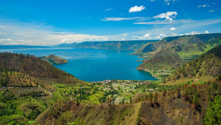
Jakarta – Lake Toba, the crown jewel of North Sumatra and the largest volcanic lake in the world, is facing an existential environmental crisis. For years, residents, local businesses, and environmentalists have observed a disconcerting trend: the water levels of this iconic caldera lake are steadily receding. This phenomenon, which carries profound implications for the region’s energy security, local fisheries, and the burgeoning tourism sector, has finally been subjected to rigorous scientific scrutiny by the National Research and Innovation Agency (BRIN).
The findings, which offer a multi-faceted explanation for the lake’s receding shoreline, suggest that there is no single culprit. Instead, the crisis is the result of a complex interplay between shifting climatic patterns, industrial development, and human-induced land-use changes.
The Core Findings: A Tale of Two Eras
The research conducted by the Center for Climate and Atmospheric Research (PRIMA) at BRIN reveals that the decline of Lake Toba is not a linear process but one punctuated by distinct historical shifts. According to BRIN researcher Hendri, analyzing the data requires a bifurcated approach, as the dynamics of the lake fundamentally changed in the mid-1980s.
"The characteristics of water level fluctuations before and after 1984 require separate analyses because that year serves as a critical turning point in the lake’s hydrological history," Hendri explained. By segmenting the data, researchers were able to identify how natural climatic variability and human intervention have acted as primary, yet distinct, drivers of the water level decline.
Chronology of Decline: From Climate Variability to Industrial Intervention
The Pre-1984 Era: The Climate-Driven Phase
Between 1957 and 1984, the lake experienced a relatively rapid decline in water levels, averaging approximately 22 millimeters per year. During this period, the primary engine of change was natural climate variability. Specifically, the recurring phenomenon of El Niño—the periodic warming of ocean surface temperatures in the central and eastern Pacific—played a dominant role.
During El Niño events, the region surrounding Lake Toba typically experiences significantly reduced rainfall. Because the lake relies heavily on direct precipitation and runoff from its surrounding catchment area, these prolonged dry spells caused the water levels to drop consistently. In this era, the lake’s hydrology was governed almost exclusively by the rhythm of the atmosphere.
The 1984 Turning Point: The Advent of Industrial Hydrology
The year 1984 marks a tectonic shift in the management of the lake. It was the year the Sigura-gura Dam and associated hydroelectric power (PLTA) infrastructure commenced operations. The construction and subsequent regulation of water flow for power generation fundamentally altered the lake’s natural discharge patterns.
Following the commissioning of these facilities, the average annual decline in water levels slowed significantly, dropping to about 2 millimeters per year. While this suggests a stabilization of sorts, it introduced a new layer of complexity: human-controlled outflow. The lake ceased to function as a natural, uninhibited basin and became a regulated reservoir, balancing the competing demands of electricity production, agriculture, and local ecosystem health.
Supporting Data: Extreme Events and Long-Term Stability
Despite the lower average rate of decline post-1984, the lake has remained susceptible to extreme volatility. BRIN’s research highlights specific years—notably 1987, 1990, 1998, and 2016—where the water levels plummeted at an alarming rate.
These extreme drops were not random; they were the result of a "perfect storm" of climatic conditions. Specifically, the combination of El Niño and the positive phase of the Indian Ocean Dipole (IOD) created extreme moisture deficits in the Indonesian archipelago. When these two climate phenomena coincide, the resulting drought is often severe enough to overwhelm the regulatory mechanisms of the hydroelectric dams, causing water levels to retreat beyond typical operating parameters.
Land-Use Transformation: The Silent Contributor
While climate change and dam operations have been the focal points of the discourse, the degradation of the surrounding ecosystem provides a critical context for the water crisis. Between 1988 and 2020, the landscape surrounding Lake Toba underwent a drastic transformation.
Data indicates that the area covered by natural forest diminished by approximately 29 percent. This loss was not merely an aesthetic or biodiversity issue; it was a hydrological failure. Natural forests act as a sponge, slowing the flow of rainwater and allowing it to percolate into the groundwater table, which eventually feeds the lake. As these forests were replaced by agricultural plantations and urban settlements, the catchment area’s ability to "recharge" the lake was significantly compromised. The increased surface runoff—which fails to be retained by the soil—means that even when it does rain, the water reaches the lake too quickly and is harder to capture, further destabilizing the lake’s water balance.
Implications: A Region in Flux
The receding waters of Lake Toba are not just a scientific curiosity; they have real-world consequences for the millions of people who depend on the lake for their livelihoods.
1. Energy Security
The Sigura-gura and Asahan hydroelectric power plants are vital to the electricity supply of North Sumatra. As water levels drop, the head pressure required to turn the turbines decreases, reducing the efficiency of power generation. If the trend continues, the ability of these plants to provide stable, renewable energy will be severely threatened, potentially leading to power shortages or an increased reliance on fossil-fuel-based alternatives.
2. Fisheries and Aquaculture
Lake Toba is home to an extensive aquaculture industry, primarily consisting of floating fish cages. As the water level recedes, the depth of the lake in near-shore areas decreases, leading to overcrowding and the concentration of waste and pollutants. This degradation of water quality has already resulted in mass fish die-offs, threatening the food security and economic stability of local fishing communities.
3. Tourism and Infrastructure
The tourism sector, which is the backbone of the local economy, faces a direct threat to its infrastructure. Many resorts, boat docks, and transport facilities were built based on historical water levels. As the shoreline retreats, these facilities find themselves stranded far from the water, necessitating expensive renovations and logistical headaches that could deter international and domestic tourists.
Official Responses and the Path Forward
BRIN’s research serves as a sobering wake-up call for policymakers. The consensus among researchers is that while global climate change is a powerful, exogenous force that cannot be easily managed at the local level, human behavior is a variable that can—and must—be controlled.
Hendri emphasizes that a holistic strategy is required. "Efforts to maintain the sustainability of Lake Toba cannot simply focus on adaptation to climate change," he states. "We require a much more prudent approach to land-use management and water resource utilization."
Recommendations for Policy Reform:
- Integrated Catchment Management: The government must prioritize the reforestation of the catchment areas to restore the natural water retention capacity of the soil. This involves strict enforcement against illegal logging and promoting agroforestry practices that mimic natural forest structures.
- Dynamic Water Regulation: The operation of hydroelectric facilities must be updated to reflect current climate realities. This may involve adopting more flexible operational protocols that prioritize the lake’s environmental health during periods of severe drought, even at the cost of temporary reductions in power output.
- Sustainable Development Zoning: Local authorities need to revise zoning laws around the lake. With the knowledge that water levels will continue to fluctuate, new tourism and urban infrastructure must be built with a "buffer zone" in mind, ensuring they remain functional regardless of moderate changes in the lake level.
- Multi-Stakeholder Governance: Given that the lake impacts energy, agriculture, and tourism, its management cannot be the domain of a single department. A collaborative body involving environmental agencies, the Ministry of Energy and Mineral Resources, and local government is essential to coordinate efforts and ensure that data-driven research is translated into actionable policy.
Conclusion
Lake Toba is more than a geographical feature; it is the lifeblood of North Sumatra. The BRIN research provides a clear, evidence-based roadmap of why the lake is receding. The challenge now lies in the hands of policymakers. By moving away from reactive measures—such as dredging or emergency water diversion—and towards a proactive, science-led management framework, there is still time to preserve this iconic landscape.
The decline of Lake Toba is a testament to the fact that even the largest natural systems are vulnerable to the cumulative impact of human activity. Whether the lake returns to its former grandeur or continues to shrink will depend on our willingness to balance economic growth with the fundamental necessity of ecological stewardship. As the research concludes, the time for integrated, sustainable action is not in the future—it is now.